Worldwide, the number of intense tropical storms has increased 80%, according to an article published by Science magazine in 2005.
According to recent studies, while the total number of hurricanes per year did not increase, the percentage of category 4 and 5 hurricanes did sharply increase during the last 35-40 years.
Most researchers agree that the warming oceans are the result of rising amounts of greenhouse gases in the atmosphere, also known as global warming. This process occurs when there are high levels of carbon dioxide in the atmosphere.
Global warming and hurricanes are linked because heat essentially is the fuel of these storms. Researchers have described hurricanes as heat engines that draw their energy upward from the warm ocean water to drive their winds; the increase in ocean temperatures is like throwing a log on a fire.
Typhoon Tip, October 1979: largest and most intense tropical cyclone ever recorded with wind speeds of 190mph, killed 99 people in its path across the Pacific, mostly in Japan
Hurricane Allen, August 1980: strongest Atlantic hurricane by wind speed, with sustained winds of 190mph, caused nearly 300 deaths in Haiti and severe damage in the US state of Texas
Bangladesh cyclone known as 02B, April 1991: at least 138,000 died and up to 10 million made homeless after a 20ft storm surge
Odisha or Paradip cyclone,October 1991: the strongest ever recorded in the northern Indian Ocean, killed about 10,000 people, mostly in India
Hurricane Katrina, August 2005: killed at least 1,836 people after striking states of Louisiana and Mississippi and was the costliest storm in history, causing $81.2 billion in damage (with wind speeds of 175mph)
Hurricane Wilma, October 2005: most intense tropical cyclone in the Atlantic basin with wind speeds of 185mph, killing 87 people on its path through the Caribbean and Gulf of Mexico
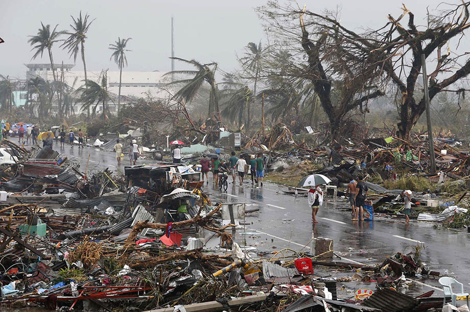
Typhoon Haiyan, November 2013: the strongest storm recorded at landfall, with one-minute sustained wind speeds of 197mph, it devastated parts of the Philippines, killing at least 6,300 people
Mexican residents in parts of the country’s Pacific coast have been moved ahead of the arrival of Hurricane Patricia.
Authorities also closed ports in the area.
Officials have warned that the Category 5 Storm could be the strongest ever to hit Mexico’s Pacific coast.
A state of emergency has been declared in three states in the path of Hurricane Patricia.
The hurricane is expected to make landfall late on Friday, October 23, with winds up to 185 mph.
The US National Hurricane Center said Patricia was potentially catastrophic.
Photo AFP
Some 400,000 people live in vulnerable areas, according to Mexico’s National Disaster Fund.
Hurricane Patricia, which will bring torrential rain, could trigger flash floods and mudslides, the US centre said.
It also warned of potential flooding from the sea.
According to forecasters, Hurricane Patricia will make landfall in the western state of Jalisco, home to the resort town of Puerto Vallarta, which could lie directly in its path.
Shop owners in Manzanillo, a major port in neighboring Colima state, have begun boarding up windows.
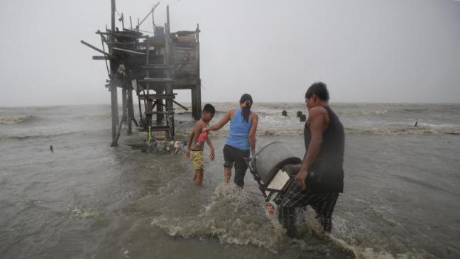
Typhoon Koppu hit the northern Philippines killing at least two people and forcing tens of thousands from their homes.
Heavy rain and floods are affecting dozens of villages.
Troops have been deployed to help residents trapped on rooftops, but are struggling to access more remote areas.
Koppu has now been downgraded to a severe tropical storm by the Japanese Meteorological Agency, which is responsible for naming and tracking it.
However, the Philippines’ own weather agency, which calls the weather system Lando, is still characterizing Koppu as a typhoon.
Despite weakening, Koppu is expected to keep dumping rain on the country for a considerable time to come. Some forecasts suggest it may not be until October 21 that it moves past the Philippines and on to Taiwan.
Typhoon Koppu made landfall near the town of Casiguran on the main island of Luzon on October 18, bringing winds of close to 124mph and cutting power to vast areas.
A teenager was killed by a fallen tree in Manila which also injured four others. A concrete wall also collapsed in the town of Subic, northwest of Manila, killing a 62-year-old woman, officials said.
On October 19, wind speeds were down to 93 mph in the northern town of Santiago, according to the state weather service.
However, floodwaters are preventing even military vehicles reaching many of the worst-hit villages, and rescuers report a shortage of boats.
“We haven’t reached many areas. About 60% to 70% of our town is flooded, some as deep as three meters,” said Henry Velarde, vice mayor of Jaen, a town in Nueva Ecija province.
“There are about 20,000 residents in isolated areas that need food and water.”
While the Philippines is no stranger to typhoons and tropical storms, the slow-moving nature of Koppu means heavy rain will fall for longer than usual, bringing greater risk of flooding and landslides.
Typhoon Koppu is the second strongest storm to hit the Philippines in 2015.
Typhoon Koppu has hit the northern Philippines forcing thousands of people to leave their homes.
According to local reports, homes have been flattened and power lines toppled.
Typhoon Koppu made landfall near the town of Casiguran on the island of Luzon on Sunday morning, October 18.
It brought winds of close to 124mph and whipped up coastal surges 12ft high.
Three days of torrential rain has been predicted, triggering major flooding and possibly landslides.
Alexander Pama, head of the government’s main disaster agency, said 10,000 people had been displaced in north-eastern Luzon but no casualties had been reported so far.
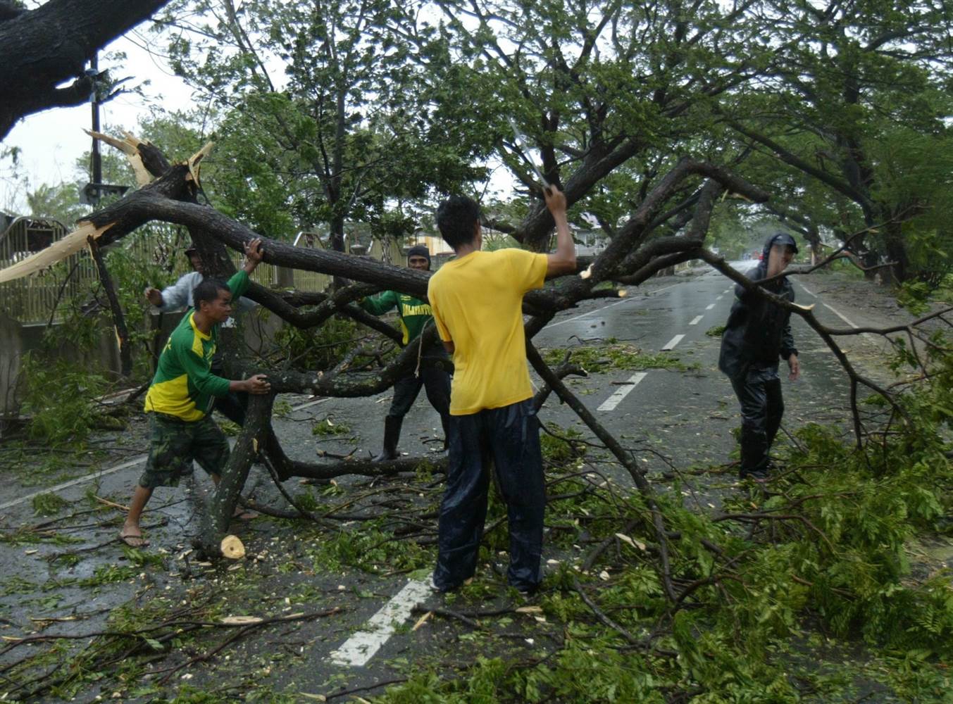
“Initially, we are getting [reports that] many houses were destroyed, power lines toppled and trees blocking major roads,” he said.
The eye of the storm was moving west at a speed of just 2mph.
“It has slowed almost to a crawl. We were hoping it would speed up and spare us sooner,” Alexander Pama added.
Flights and ferry services in the north have been cancelled and some bus services in mountain areas suspended due to the threat of landslides.
Typhoon Koppu, also known as Lando, is up to 400 miles across and producing winds of up to 155mph. It is slow moving, meaning it could bring intense rain over a long period of time.
Rain has also reached the capital Manila, though winds are not expected to be strong enough there to cause damage.
In his TV address, President Benigno Aquino urged the estimated six million people in the typhoon’s direct path to listen to government warnings and be ready to evacuate their homes if necessary.
He said aid agencies had already distributed emergency supplies to evacuation centers.
Meanwhile, the Philippine military in northern Luzon has been placed on alert for disaster operations.
Typhoon Koppu is not due to leave the Philippines until October 20, when it will be heading towards Taiwan.
The Philippines is preparing for Typhoon Koppu that is forecast to dump heavy rain and cause severe flooding when it arrives at the weekend.
On October 16, President Benigno Aquino warned people living in the path of Typhoon Koppu to be ready to evacuate.
In a TV address, Benigno Aquino said the storm could bring up to 12 hours’ torrential rain and cause severe flooding.
It was Benigno Aquino’s first such appeal since Typhoon Haiyan struck in 2013, leaving more than 6,000 people dead.
Typhoon Koppu is due to hit the northern island of Luzon early on October 17.
Forecasters say it is packing winds of up to 115mph and is slow moving, meaning it could bring intense rain over a long period of time.
In his address, Benigno Aquino urged the estimated six million people in the typhoon’s direct path to listen to government warnings and be ready to evacuate their homes if necessary.
He said aid agencies had already distributed emergency supplies to evacuation centers.
The state weather service warned residents on the east coast of Luzon to be ready for possible storm surges of more than 6ft.
Meanwhile, the Philippine military in northern Luzon has been placed on alert for disaster operations.
Typhoon Koppu, also known as Lando, is not due to leave the Philippines until October 20, when it will be heading towards Taiwan.
In November 2013, Super Typhoon Haiyan – the strongest storm ever recorded on land – swept into the Philippines, destroying entire towns and leaving more than 6,300 people dead and more than 1,000 missing.
According to new reports, at least 19 people have been found dead following flash floods on the French Riviera.
The death toll rose after two bodies were discovered on October 5. One person remains missing but another was found alive, according to reports.
Violent storms and heavy rain on Saturday evening sent torrents of water and mud through several towns.
A Briton, an Italian woman and a Portuguese man were also among those killed, AFP said.
French President Francois Hollande has announced a state of “natural disaster” in the affected region.
Forecasters have faced criticism over the effectiveness of weather alerts.
The area is estimated to have received more than 10% of its average yearly rainfall in two days alone. Rivers burst their banks, sending water coursing into nearby towns and cities.
Photo Reuters
Divers found one body in the worst-hit town of Mandelieu-la-Napoule on October 5.
Eight are now confirmed killed there after being trapped in garages when they tried to remove their cars, officials say.
Three elderly people drowned when their retirement home in Biot, near the city of Antibes, was flooded.
Visiting the home on October 4, President Francois Hollande offered his condolences and urged residents to remain cautious, saying: “It’s not over.”
Hundreds of volunteers have been helping clear debris and clean homes affected.
Thousands of homes remained without electricity on October 5 following the floods.
Meanwhile Bernard Giampaolo, director of the Marineland amusement park in Antibes, said three loggerhead turtles were still missing after the enclosures were hit.
He told Nice Matin newspaper that polar bears, orcas and dolphins had survived, although the park was still without power.
Chickens, goats and sheep had been washed away, the newspaper reported.
South Carolina Governor Nikki Haley says rainfalls in parts of the state have been higher than at any time “in 1,000 years”, with at least six reported deaths as a result of the floods.
More than 13 inches has fallen in three days in the historic city of Charleston.
Schools will shut on October 5 and several inter-state highways have been closed.
The torrential rains have been made worse by a weather system connected to Hurricane Joaquin in the Caribbean.
Hurricane Joaquin is not expected to hit the eastern US, but the moisture associated with it is contributing to heavy rainfall.
“We haven’t seen this level of rain in the low country in 1,000 years. That’s how big this is,” Governor Nikki Haley said on October 4.
Photo NBC News
Nikki Haley urged residents to stay indoors.
“The water is not safe and a lot of areas across the state where you see this deep water, it’s got bacteria in it. So, stay inside and don’t get in there,” she said.
President Barack Obama has declared a state of emergency in South Carolina. The move means state and local authorities can receive federal help to deal with the flooding.
“We have every ambulance in the county out responding to calls. People are being moved from their homes in boats,” Georgetown County spokeswoman Jackie Broach told Reuters.
About 100 people were rescued from their cars on flooded roads on October 3.
In Charleston, many streets have been closed and sandbags have been piled up to keep floodwaters out.
At least three people have died in Japan’s severe flooding and hundreds of people are stranded.
The deaths were in the badly hit prefectures of Tochigi and Miyagi, both north of the capital, Tokyo.
According to officials, 26 people are still missing, 25 of them in or around Joso city in Ibaraki, where the Kinugawa River burst its banks on September 10.
Officials have warned of further heavy rain and the risk of mudslides.
The torrential rain comes in the wake of Typhoon Etau, which ploughed through Japan earlier this week.
Officials have confirmed that a 63-year-old woman was killed when her house was hit by a landslide in Kanuma City in Tochigi.
A second woman, 48, was killed after her car was swept away in Kurihara city in Miyagi. And in hot spring resort of Nikko in Tochigi, a man died after falling into a drain he was trying to clear.
At least 27 people have been injured, eight seriously.
In Joso, nearly 6,000 emergency service workers are trying to reach stranded people. Many rescuers had worked through the night.
Photo Reuters
Officials in the city of 60,000, about 30 miles northeast of Tokyo, said 22 people there had lost contact after requesting help. NHK reported that two eight-year-old children were believed to be among them.
Akira Motokawa, a Joso city evacuation official, told national broadcaster NHK that rescuers had been unable to keep up with the volume of calls for help.
Thousands have been taken to temporary shelters, many carrying almost nothing with them.
Floodwaters in Joso had subsided somewhat by September 11, but much of the city was still under water and it is not clear when evacuees will be able to return home.
Takuya Deshimaru, chief forecaster at the Japan Meteorological Agency (JMA), has said the rainfall over the past few days was “unprecedented”.
In Tochigi, more than 19 inches of rain fell in 24 hours in places, double the amount that normally falls there throughout the whole of September, according to NHK.
Parts of central Tochigi have seen almost 24in of rain since September 7, breaking records.
A severe rain warning remains in effect for large areas of northeastern Japan.
Hundreds of thousands of people in Japan have been advised to evacuate their homes, as the country is on high alert over heavy rains and flooding following Typhoon Etau.
Typhoon Etau brought winds of up to 78mph to central Aichi prefecture on September 9 before moving out to sea.
Heavy rain continued to drench eastern Japan on September 10.
“This is a scale of downpour that we have not experienced before. Grave danger could be imminent,” the chief forecaster at the Japan Meteorological Agency, Takuya Deshimaru, told an emergency press conference.
The hardest-hit area on September 10 was north of the capital, in Ibaraki and Tochigi prefectures.
The Fire and Disaster and Management Agency said one person is missing and 15 others had been injured, two seriously, both of whom were elderly women knocked over by strong winds.
Local media has reported one person missing after a landslide hit a house in Kanuma, Tochigi prefecture.
Some areas had power outages and parts of Tokyo saw flooding as authorities on September 10 advised about 900,000 people in the capital and other parts of the country to leave their homes.
The extreme weather also disrupted transport links, with dozens of flights cancelled and bullet train services partially suspended.
Last month, powerful Typhoon Goni hit Japan’s southernmost main island of Kyushu, killing at least one person and injuring 70 others.
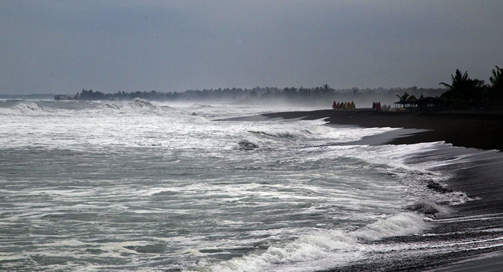
Tropical Storm Erika hit the island of Dominica, in the eastern Caribbean, killing at least 20 people.
The storm caused floods and mudslides that have set the country back 20 years, Dominica’s PM Roosevelt Skerrit said.
Haiti and the Dominican Republic are now expecting 53mph winds.
A state of emergency has been declared in Florida, where the storm is expected on August 30.
PM Roosevelt Skerrit said in a televised address on August 28 that hundreds of homes, bridges and roads had been destroyed.
Photo AP
He said: “It is with heavy heart that I address you, you can well imagine the hell that it has been for me since I heard of the passing of Tropical Storm Erika and the damage it has done to our dear people and beloved country. But we all have to pull ourselves together.
“The extent of the devastation is monumental. We have, in essence, to rebuild Dominica.”
Erika dumped 15in of rain.
At least 31 people on the island of 72,000 people have been reported missing, according to officials with the Barbados-based Caribbean Disaster Emergency Response Agency.
Other Caribbean nations have issued tropical storm warnings.
In Puerto Rico, Erika knocked out power to more than 200,000 people and caused more than $16 million of damage to crops including plantain, bananas and coffee, AP reported.
The US National Hurricane Centre said the system was expected to move north across the island of Hispaniola – shared by Haiti and the Dominican Republic – where the high mountains would weaken it to a tropical depression on Saturday.
Meanwhile, Florida Governor Rick Scott declared a state of emergency as a precaution with officials urging people to prepare by stockpiling food and water and fuelling their vehicles.
Separately, in the Pacific Ocean, Hurricane Ignacio strengthened into a hurricane with maximum sustained winds of 90mph, centered south-east of Hilo in Hawaii, and moving north-west.
Typhoon Soudelor has hit south-eastern China prompting the evacuation of thousands of people and leaving millions of homes without power.
The powerful typhoon struck Fujian province late on Saturday night, bringing rains and gale force winds, state media said.
It earlier swept across Taiwan, leaving at least five people dead.
Although it has weakened, typhoon Soudelor is expected to continue moving across the region in the coming hours.
Fujian raised its typhoon alert to the highest level in anticipation of the storm, with at least 163,000 people evacuated to higher ground. There are reports of more evacuations in neighboring Zhejiang.
Photo AP
Rail services and flights have been cancelled in the path of the storm, and schools and offices closed.
Taiwan earlier on Saturday saw winds of more than 142mph, when Soudelor made landfall.
It ripped up trees and tore down billboards, and triggered a landslide in at least one village.
Among the victims were an 8-year-old girl and her mother who were swept out to sea.
A firefighter was reportedly killed after being hit by a drunk driver as he tried to move a fallen tree.
Typhoon Soudelor gradually lost its strength as it crossed the island, but was still packing winds of up to 89mph over the strait between Taiwan and China.
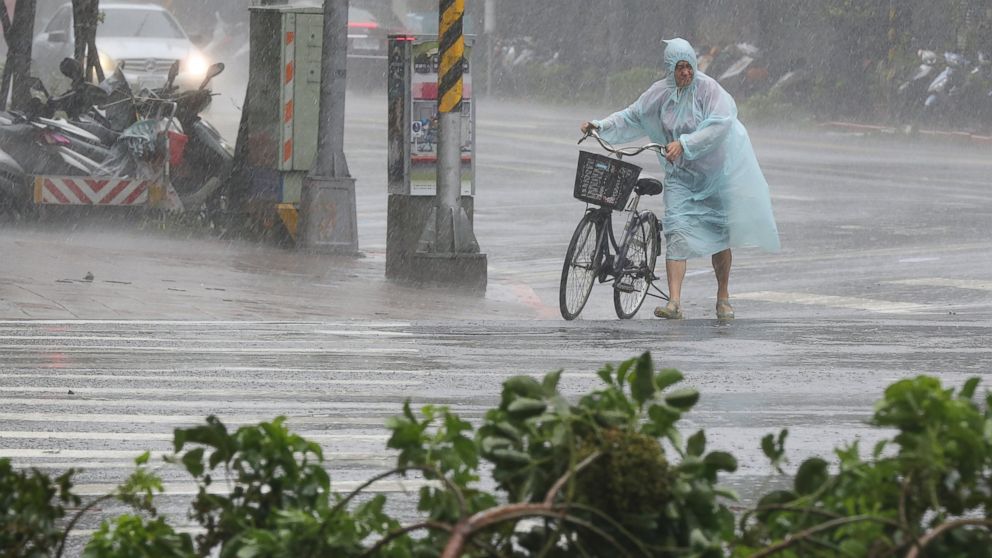
Typhoon Nangka made landfall in southern Japan on July 16.
Authorities urged at least 350,000 people to leave their homes.
Typhoon Nangka hit the island of Shikoku, bringing torrential rain and winds of up to 115 mph.
Kyodo news agency reported at least two deaths while broadcaster NHK said at least 31 were injured.
Nangka has since weakened and been downgraded to a tropical storm, but officials have warned of continued strong winds and storms in the area.
As of July 17, the Japan Meterological Agency warned of high waves, gales and thunderstorms in many parts of the main island of Honshu, as the storm headed north.
Typhoon Nangka is currently moving slowly at 10mph with a maximum sustained wind speed of 60mph, according to the Japan Meteorological Agency.
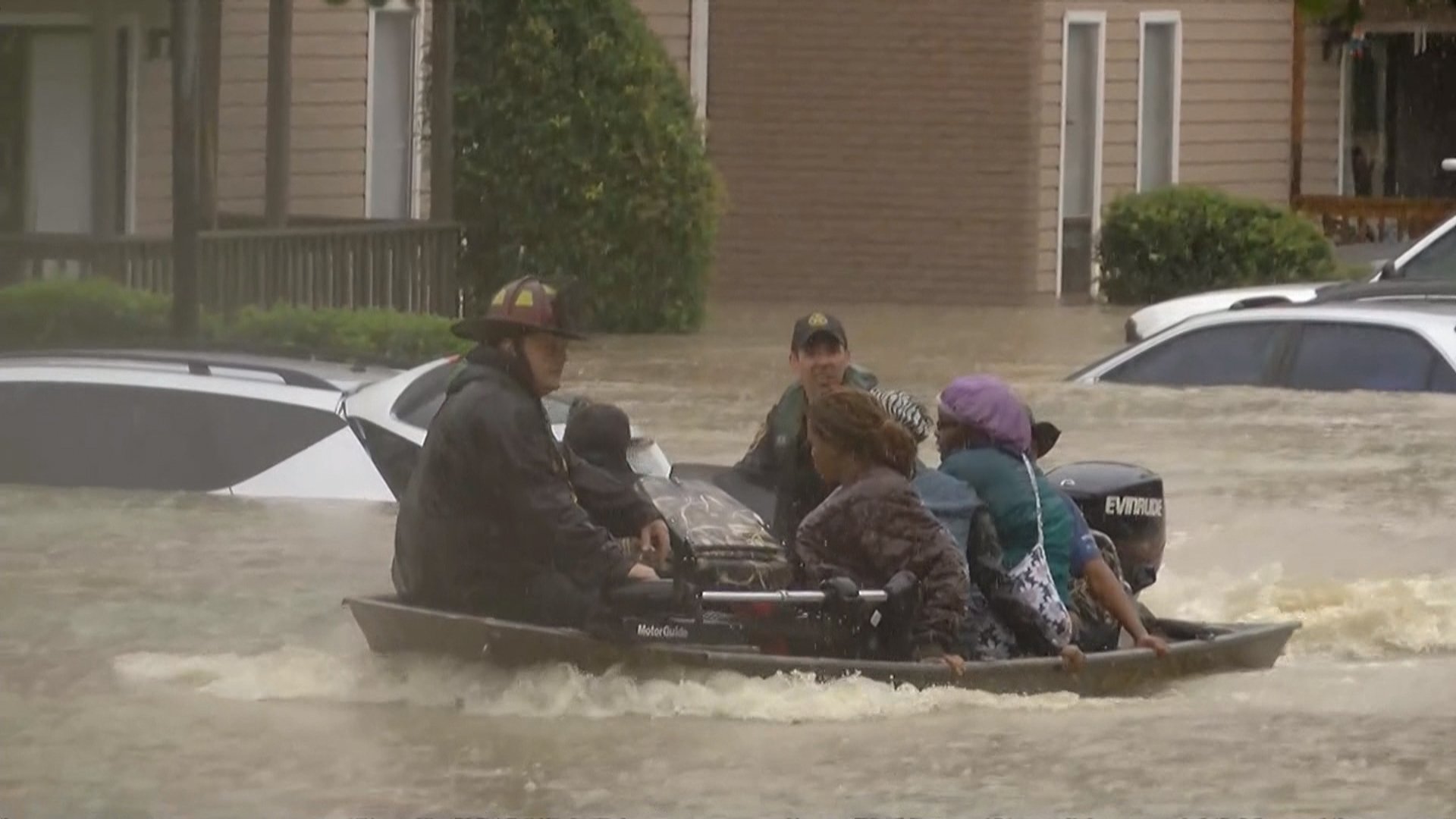
According to official reports, at least 17 people have been killed and dozens injured in Oklahoma and Texas following record rainfall over the weekend.
At least four deaths have been blamed on the storm in the Houston area. The storm led to major flooding and tornadoes sweeping across the southern part of America.
More heavy rains are expected over the next few days.
Parts of Houston – the US’s fourth most populous city – remain under water.
Thousands of cars have been abandoned on city streets and highways.
Scores of residents have been displaced and more than 1,000 homes have been destroyed.
The number of people killed in Texas and Oklahoma is expected to rise as more bodies are discovered, officials say.
By May 26, most rivers in Houston were reported to have receded back within their banks.
The floodwaters affected virtually every part of the city, officials say, bringing some areas to a standstill.
Fire fighters rescued scores of stranded motorists and at least 2,500 vehicles were abandoned by drivers, officials said.
Texas Governor Greg Abbott has declared a state of emergency in 24 counties in Texas.
The bad weather does not appear to be coming to an end – forecasts have predicted a 20% to 40% chance of thunderstorms for the rest of the week in Houston.
The effects of the massive storms were also felt near the Texas border in Mexico.
On May 25, at least 14 people – including an infant – were killed by a tornado that hit the northern Mexico border city of Acuna.
Mexican authorities said that more than 1,000 homes were damaged by the storm.
Texas often experiences long periods of drought, despite heavy rainfall at times.
As of the week of May 19, areas in central Texas were experiencing abnormal to severe levels of drought, with 795,851 residents affected, according to the Texas Commission on Environmental Quality.
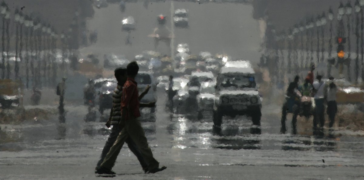
The recent heat wave has killed more than 1,000 people in India as temperatures nearing 122F (50C) in some areas.
Most deaths have taken place in the southern states of Telangana and Andhra Pradesh, where at least 1,118 people have died since last week.
At least 24 people have died from the heat in West Bengal and Orissa.
Temperatures are likely to drop in some parts over the coming days.
Hospitals are on alert to treat heatstroke patients and authorities have advised people to stay indoors.
Heat wave conditions have been prevailing in the two worst-affected southern Indian states since mid-April, but most of the deaths have happened in the past week.
In the worst-hit state of Andhra Pradesh, where temperatures climbed to 47C on May 25, 852 people have died.
“The state government has taken up education programs through television and other media to tell people not to venture into the outside without a cap, to drink water and other measures,” news agency AFP quoted P Tulsi Rani, special commissioner for disaster management in the state, as saying.
“We have also requested NGOs and government organizations to open up drinking water camps so that water will be readily available for all the people in the towns,” P Tulsi Rani added.
In neighboring Telangana state, 266 people have died in the last week as temperatures hit 118F (48C) over the weekend.
Temperatures fell slightly in Telangana on May 26, and are expected to start dropping in Andhra Pradesh by the end of the week.
The weather is likely to cool further when the summer monsoon begins at the end of the month.
The Indian capital, Delhi, is enduring a week of sweltering heat as the maximum temperature in the city hit a two-year high of 114F (45.5C) on May 25.
The meteorological department has issued a warning for Orissa, Jharkhand and Andhra Pradesh states saying that maximum temperatures there would remain above 113F (45C).
Meteorological officials said the heat wave was due to a lack of rain.
There are fears that some of the worst-affected states could be hit by drought before the monsoon rains arrive.
The monsoon is expected to hit the southern state of Kerala towards the end of this month before sweeping across India.
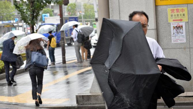
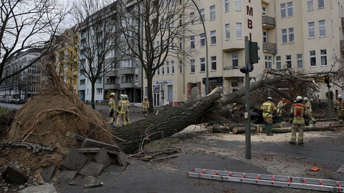
Nine people are reported dead after a strong storm hit Germany, Austria, Switzerland and the UK.
Seven people were killed in Germany, including two men whose car was hit by a tree.
German media reports that there have been dozens of injuries from flying branches.
In Austria, a man fell from a ladder and suffered fatal head injuries while securing an awning over his patio.
Forecasters said that on Germany’s highest mountain, the Zugspitze, winds of more than 118 mph were recorded.
Rail services were disrupted and the main station in Munich had to be evacuated due to concerns that parts of the roof might collapse.
A man in the UK was seriously injured when his car was crushed by a falling tree.
The biggest winds in the Netherlands were put at 75mph by weather site Weeronline. Toppled trucks were left scattered across Dutch roads.
As the storm, dubbed Niklas, swept from the west across Germany, regional rail services came to a halt in Lower Saxony and North Rhine-Westphalia, while many Germans were trying to get away ahead of the Easter holiday period.
A man was killed when a concrete wall fell on top of him in the eastern town of Gross Santersleben, police said.
Flights were disrupted at airports in Frankfurt, Hamburg and Munich.
According to the Indonesian weather agency (BMKG), bad weather was the biggest factor in the crash of AirAsia flight QZ8501.
The BMKG agency said initial analysis suggested icy conditions in the air had caused the engine to stall.
The Airbus A320 vanished with 162 people aboard en route from Surabaya in Indonesia to Singapore on December 28.
The discovery of four large objects believed to be plane debris has raised hopes of finding the fuselage, where most bodies are believed to be trapped.
Just 30 bodies had been recovered from the Java Sea as of January 3.
The plane’s black boxes, its flight data and cockpit voice recorders, have yet to be located.
BMKG found conditions at the time of the plane’s disappearance suggested it had probably flown into a storm.
“From our data it looks like the last location of the plane had very bad weather and it was the biggest factor behind the crash,” said Edvin Aldrian, head of research at BMKG.
“These icy conditions can stall the engines of the plane and freeze and damage the planes machinery.”
Officials have said the plane was travelling at 32,000ft when the pilot’s last communication was a request to climb to 38,000ft to avoid bad weather.
Search chief Bambang Soelistyo said four large objects as well as oil slicks had been detected by sonar.
The biggest object is 59ft long and 18ft wide, he was quoted as saying by the Associated Press news agency, adding he believed the objects were parts of the plane. Another object is said to be 32ft long.
Bambang Soelistyo said an ROV (remotely operated underwater vehicle) was being lowered into the water to get an actual picture of the objects, which were at a depth of 98ft.
But he warned that waves up to 17ft high were hampering the search effort.
A flotilla of ships, including two from the US navy, are converging on the site where the objects were located and preparing to put divers into the water.
A Russian search team, including 22 deep water divers and a remotely operated submersible vessel, is expected to join the hunt for the black boxes after arriving in Pangkalan Bun on January 3.
It has emerged that AirAsia did not have official permission to fly the Surabaya-Singapore route on the day of the crash but was licensed on four other days of the week.
The Indonesian authorities suspended the company’s flights on this route pending an investigation. AirAsia said it would “fully co-operate”.
Bad weather is expected to put a dampener on 4th of July celebrations in the south and mid-west with rain and threats of heavy flooding on Thursday.
The unsettled conditions could upset favorite holiday activities including firework displays, barbecues and days at the beach.
In the north-east, coastal areas will be mainly dry on Thursday following scattered showers and thunderstorms in West Virginia, upstate New York, northern Vermont and New Hampshire today.
Parties in the south may take a hit according to the Weather Channel. Rain and thunderstorms have been forecast from the eastern Gulf Coast to Tennessee, Kentucky and the southeast.
There is a danger of heavy flooding in northern Georgia, northern Alabama, eastern Tennessee, eastern Kentucky, the far western Carolinas and the mountains over the next 48 hours.
It is also expected to be a washed-out Fourth for the Midwest from eastern Ohio to the Great Lakes.
Bad weather is expected to put a dampener on 4th of July celebrations in the south and mid-west with rain and threats of heavy flooding on Thursday
However. there is better news for the Plains where Thursday will be dry with temperatures climbing to 90F.
There will be the odd thunderstorm on the Fourth from the Southwest to Northwest at higher altitudes.
Extreme heat and dry conditions are being forecast for Thursday in the southwest. Temperatures of 110F are expected from southern Nevada into the California and western Arizona deserts.
Although dry conditions are expected in the west, firework displays may be canceled because of droughts and fire bans.
However, most bans are only in place for private properties and towns will hold exhibitions.
It is expected to be the reverse on the east coast, where there will be scattered showers.
Meterologist Alex Sosnowski told Accuweather.com: “The pattern through Independence Day and the weekend beyond in some Eastern locations favors additional widely separated torrential downpours and conditions favoring fog in some locations.”
However he added: “A pocket of mostly rain-free weather will stretch from the coastal part of the Carolinas to Washington, D.C., Philadelphia, New York City and perhaps Boston on Thursday evening.”
The Plains looks likely to be the best region for Fourth of July firework celebrations with low humidity and gentle breezes forecast.
A strong winter storm last night dumped heavy snow on New York and New Jersey, also pummeled by Hurricane Sandy last week – even forcing FEMA to shut its doors to families in need.
FEMA shuttered its recovery centers, which were set up to offer assistance to those most affected by the monster storm, and the Staten Island office closed “due to bad weather”.
The Nor’easter rattled the East Coast with high winds and piles of wet, slushy snow on Wednesday – leaving thousands of Sandy victims without power just after it had been restored.
Adding to the mess, the three major airports in the tri-state area closed, commuter trains slowed service, and mass transit lurched to a halt, inflicting another round of misery on the city’s residents.
The storm dropped nearly four inches of snow in Central Park, which areas of southern New Jersey suffered more than 9 inches, the National Weather Service said.
Residents from Connecticut to Rhode Island were also slammed with up to six inches of snow, while areas of Massachusetts had a whopping eight inches.
Carrying gusts of 60 mph, the storm brought down tree limbs and electrical wires damaged by Sandy. Utilities across the two states in New York and New Jersey reported that nearly 60,000 customers who lost power in the superstorm lost it again.
“It’s Mother Nature’s one-two punch,” Mayor Cory Booker of Newark, New Jersey, told CNN.
“It’s testing the resolve and the grit of my state and my city and, obviously, this region.”
Airlines cancelled at least 1,300 U.S. flights in and out of the New York metropolitan area on Wednesday, causing a new round of disruptions that rippled across the country. And on the roads, icy conditions brought traffic to a crawl.
Despite this newly-inflicted chaos and slushy sidewalks across the tri-state area, schools across New York City opened on Thursday, including 43 schools still without power or damaged by Sandy.
Transit systems have also spluttered back to a start, with the Long Island Rail Road running all lines by 5:00 a.m. except for the Long Beach line.
The Nor’easter rattled the East Coast with high winds and piles of wet, slushy snow on Wednesday leaving thousands of Sandy victims without power just after it had been restored
Commuter traffic also reopened in the Holland Tunnel, where around 90,000 vehicles pass under the Hudson River between Manhattan and Jersey City, New Jersey.
Airlines at the city’s airports were also scheduled to resume flights on Thursday, but officials warned travelers to check with their carriers ahead of the storm.
The states’ utilities reported scattered outages on Thursday, with some customers complaining that they had just gotten their electricity back in the past two day or two, only to lose it again.
The Long Island Power Authority said 200,000 customers were without power, with around 50,000 losing it in the new storm.
Con Edison reported the storm knocked out electricity to about 60,000 customers in New York City and Westchester County. On Thursday, these customers included 21,000 in Queens, 7,000 in Brooklyn, 4,000 in the Bronx, 3,900 in Staten Island and 140 in Manhattan.
Public Service Electric & Gas reported 160,000 outages, including 40,000 caused by the new storm.
Jersey Central Power & Light has about 238,000 customers without power, while Atlantic City Electric reported more than 5,000 customers without power.
The Nor’easter also cut a feed to a substation briefly on Wednesday night, knocking out power to 8,000 customers around East Brunswick, New Jersey.
Ahead of the storm, authorities had warned communities they could be pummeled by this latest bout of bad weather and in New York, police went to low-lying areas with loudspeakers, urging residents to leave.
New York Mayor Michael Bloomberg didn’t issue mandatory evacuations, and many people stayed behind, some because they feared looting, others because they figured whatever happens couldn’t be any worse than what they have gone through already.
The city manager in Long Beach, New York, urged the roughly 21,000 people who ignored previous mandatory evacuation orders in the badly damaged barrier-island city to get out.
More than 600 residents were moved from three nursing homes and an adult care facility in the Rockaway area in Queens amid fears that the weather would knock out electricity.
Public works crews in New Jersey built up dunes to protect the stripped and battered coast.
All construction in New York City was halted – a precaution that needed no explanation after a crane collapsed last week in Sandy’s high winds and dangled menacingly over the streets of Manhattan.
Parks were closed because of the danger of falling trees. Drivers were advised to stay off the road after 5:00 p.m.
Forecasters had said the nor’easter would bring moderate coastal flooding, with storm surges of about three feet possible Wednesday into Thursday – far less than the 8 to 14 feet Sandy hurled at the region.
“I am waiting for the locusts and pestilence next,” New Jersey Gov. Chris Christie had said.
“We may take a setback in the next 24 hours.”
Hurricane Sandy killed more than 100 people in 10 states, with most of the victims in New York and New Jersey.
On Tuesday, the death toll inched higher when a 78-year-old man died of a head injury, suffered when he fell down a wet, sandy stairwell in the dark, authorities said.
Long lines persisted at gas stations but were shorter than they were days ago.
At the peak of the outages from Sandy, more than 8.5 million customers lost power. Before the nor’easter hit, that number was down to 675,000, nearly all of them in New Jersey and New York.
This website has updated its privacy policy in compliance with EU GDPR 2016/679. Please read this to review the updates about which personal data we collect on our site. By continuing to use this site, you are agreeing to our updated policy. AcceptRejectRead More
Privacy & Cookies Policy
Privacy Overview
This website uses cookies to improve your experience while you navigate through the website. Out of these, the cookies that are categorized as necessary are stored on your browser as they are essential for the working of basic functionalities of the website. We also use third-party cookies that help us analyze and understand how you use this website. These cookies will be stored in your browser only with your consent. You also have the option to opt-out of these cookies. But opting out of some of these cookies may affect your browsing experience.
Necessary cookies are absolutely essential for the website to function properly. This category only includes cookies that ensures basic functionalities and security features of the website. These cookies do not store any personal information.
Any cookies that may not be particularly necessary for the website to function and is used specifically to collect user personal data via analytics, ads, other embedded contents are termed as non-necessary cookies. It is mandatory to procure user consent prior to running these cookies on your website.