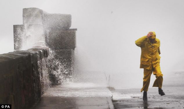
Hurricane Katia’s remnants hit Britain this morning.
Britain is facing the second day of storms as the remnants of Hurricane Katia continue to batter vast swathes of the country today.
Severe weather warnings have been issued for Scotland and northern England, with winds expected to reach 60 mph (100 km/h) later in the day.
Power outages, falling masonry, downed trees and transport chaos struck as gales reached 82 mph (130 km/h) in Wales and north of England, reviving memories of the Great Storm of 1987.

A yellow alert – the second-highest of four warning levels – had been issued by the Met Office for much of the country as roads were closed and ferry services cancelled.
Ten flood warnings were issued as waves and high tides threatened to overwhelm coastal defences in the North East and southern Scotland.
Thousands of homes, shops and businesses across central England were blacked out for hours as wind speeds of more than 50 mph (80 km/h) damaged an overhead power line. Central Networks said 2,000 homes in Oxfordshire, Northamptonshire, Derbyshire and Gloucestershire were left without electricity.
Tour of Britain cycle race was cancelled over safety fears.
The remnants of Hurricane Katia hit Britain yesterday morning, bringing the worst storms since the remnants of Hurricane Lili wreaked havoc in 1996.
Met Office forecaster Sarah Holland said today:
“Winds will reach 60mph in exposed areas of northern England and southern Scotland with 50mph inland, and about 30-40mph in the Midlands.
“High tides and the full moon mean there is a higher risk of tidal flooding.”
The Environment Agency issued nine flood alerts on Monday for the north-west coast from Morecambe Bay in Cumbria down to Blackpool, North Wales and Anglesey, and one for the north-east coast at Bridlington in Yorkshire.
The blustery conditions will tail off in the Midlands and south of England by Wednesday and across the whole country by Thursday.
The storm caused havoc for passenger aircraft attempting to land at England’s highest airport, Leeds Bradford International Airport in Yorkshire.
A Ryanair jet was forced to abort its landing after being blown sideways across the runway, while a Flybe jet managed to touchdown safely despite heavy winds interfering with its flight path.
Ports around Britain have been battered by huge waves leading to the cancellation of ferries while trees have been uprooted, causing damage to cars and houses.
Increasing wind speeds as the hurricane approached forced the cancellation of high speed ferries to France from Portsmouth.
The transportation company, Brittany Ferries said it was scrapping its high speed ferries on two crossings scheduled from Portsmouth to Cherbourg yesterday.
Safety regulations state that when waves reach a height of 10 feet (3 meters) or more the high speed crossings must not go ahead
Although the Hurricane Katia has been downgraded, it still appears to create the worst storms since 1996, when Hurricane Lili brought 90 mph (about 150 km/h) winds to these shores.